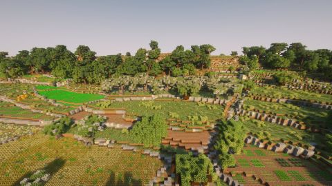
Placing giren and field rooms across the islands
From a stone box in a field corner to a corbelled dome on the bare rock: how I found Malta's field rooms and giren on maps, aerial photos and a hut survey, and built them in Minecraft, ruins included.
In short: Malta in Minecraft has 8,167 field rooms and about 320 giren. Every field room stands where a real building stands on the Planning Authority's map. The giren follow a survey of real huts and the places where the research says they cluster. It took a wrong count, a failed search on old survey sheets and several rounds of checking by eye to get the numbers right.
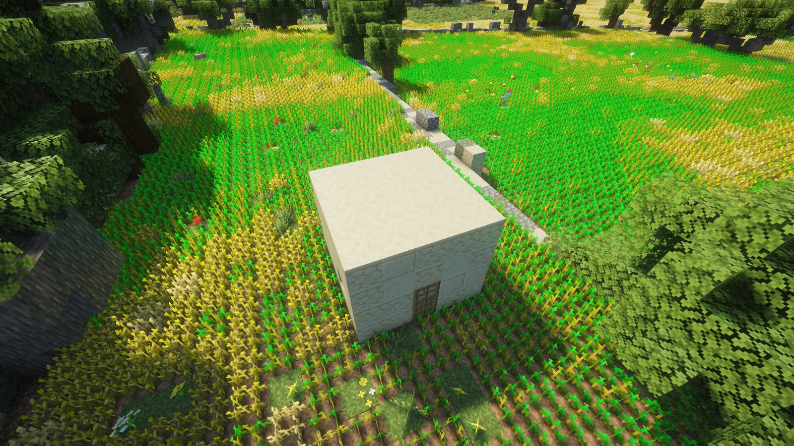
Walk through any Maltese field and you will probably find a small stone box in a corner. On the stony hills in the north-west you will find something older: a dry-stone hut shaped like a beehive. The first is a field room (kamra tal-għalqa) and the second is a girna (plural giren). This post tells how I placed both across the islands, and what I got wrong on the way. The finished pages are on the wiki: Field room and Girna.
Counting what I had
I wanted to know how common these buildings were before I decided anything else about them. My first generator put a field room in a field corner next to a track and a girna on flat karst, using a random draw. The counts were 6,106 field rooms and 2,137 giren.
The giren count was wrong. The code was meant to give about one girna per 10 hectares of karst. A cell of 10 hectares with only 0.04 hectares of flat karst in it still got a girna 7 times in 10. The real number is in the hundreds on Malta, so 2,137 was far too many. The result was one girna per 3.2 hectares of karst. I also found 17 pairs of field rooms less than 6 m apart, some of them touching.
I fixed the density first and set a gap of at least 50 m between any two buildings. Then I went looking for real data.
Field rooms from the drawn map
The Planning Authority's drawn map of the islands has every building as an outline. I took the small ones that stand among fields and away from houses. My first rule allowed at most two other buildings within 50 m. A photo check showed it threw away real rooms, because real field rooms often stand in twos and threes. Another rule banned every building within 40 m of a house. It removed about 1,200 candidates, and most of them were real rooms. The rule that works is narrower: no building larger than 60 m² within 25 m, and nothing joined to the room.
I then set a size limit of 5 by 5 blocks and added checks from the 2018 surface model and the aerial photo. 171 candidates were labelled by eye on the photo, and that gave an error of about 2 %.
That number was far too low. In the game I looked at one Mellieħa field. None of the three small buildings the generator had built there was a field room. Then I checked 50 random candidates myself, with the map and the photo side by side. 35 were field rooms, 5 were not, and 10 I could not tell, six of them hidden under trees. Of the ones I could decide, about 1 in 8 was wrong. The earlier estimate came from labels made on the photo alone, and they were not a good test.
A second round of 100 candidates gave better numbers for the normal size (48 yes, 2 no, 10 unsure) and for the tiny ones of 4 to 6 m² (33, 5, 2). I tried every measure I could think of: roof brightness, colour, texture, height. None could remove the wrong ones without also removing real rooms. Solar panels made some roofs dark, so a pale-roof rule failed too.
The test that helped was the shadow. A real field room is a box that stands up from the ground, so on the 2018 photo it casts a shadow, and the photo shows which way the sun was coming from. A rule that asks for a shadow keeps 110 of 116 real rooms. I added a label test as well: no building within 30 m of a church, chapel or convent label on the map, which are real text on the map sheets.
The final count is 8,167 field rooms, about 93 % of them real field rooms by my sample. The rest are similar small roofed buildings. On Malta that is about 62 rooms per square kilometre of farmland. From a random spot in a field, the nearest room is a median 80 m away.
Giren
Giren cannot come from the drawn map, because the map has no building types and its round buildings are mostly kiosks, fountains and tanks. I tried the 1968 survey sheets instead. They draw a girna as a small circle with a short line for the door. At one spot a symbol matched a round stone dome that stands 2 m high on the 2018 surface model.
I wrote a detector for the symbol and found 12,622 candidates. I reduced them to 113 and checked 53 myself. Three were giren, five were ruined giren, three were unsure and 42 were not: big rocks, field houses and the like. That is about 15 % real, even among the best picks. I dropped the method. The 8 real giren I had confirmed stay in the world.
What worked was Vella's (2012–2013) survey of 37 giren on the Bajda ridge. It gives their shapes (14 round, 13 oval, 8 rectangular, 3 niches in a wall), their setting (field edges, beside rubble walls, near old surface quarries) and a map. I fitted the map to the coast and got positions that are right to about 150 m, so each of the 36 mapped giren snaps to the nearest flat spot. The rest follow a density by region: 12 per 100 hectares of karst and field in the Majjistral and Mellieħa hills, 4 in the other documented areas, 2 at Dingli and 0.5 per 100 hectares everywhere else on the pale rock. That makes about 320 giren.
Two more rules came from the game. A girna can not stand on a cliff top, so I keep them at least 20 m back and off steep ground. And in a test at the Bajda ridge I found a girna hidden under a tree canopy, so none stand in woods, olive groves or where three or more tree trunks are close.
Making them look right
Giren are built from stone. My first version used one fixed mix of cobblestone, stone and andesite. I found it looked wrong next to the bare rock around it, so every stone now comes from the rock layer at that spot, with a fifth of them cobblestone. The first try took the rock a few blocks down and picked a paler bed under grey ground, so now it takes the top bed within 3 blocks.
That change also showed a bug. A coal ore blob from vanilla world generation sat inside a girna wall. Ore blobs now never start within 6 blocks of the land surface, so no field wall, room or girna holds ore.
The dome was the hardest part. A real girna roof is a corbelled dome, each course a little further in. At one block per metre, the dome turned into a stepped pyramid inside. Stair blocks under each overhanging course round it off.
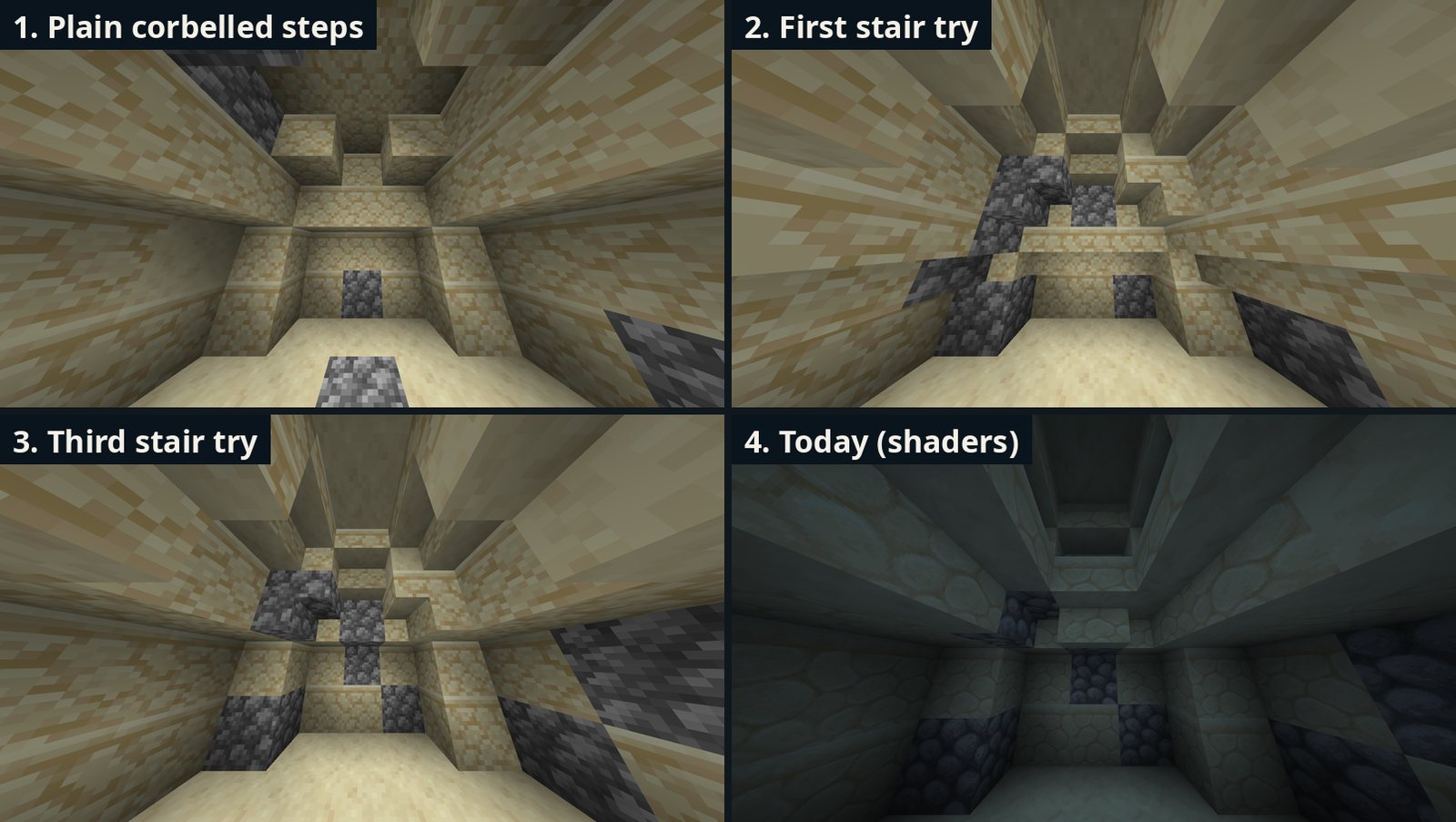
My first try ran stairs round the whole room at head height. There were far too many stairs and the room had become much smaller. The next try kept only the top ring. Marking up a screenshot showed where stairs belong: the upper rings, and no stairs at head height. That build put stairs only at the corners and it still read as a pyramid. The final build puts a stair on every wall cell of each overhanging course from the second course up.
I also made the girna in several sizes. About a third are small, 5 blocks wide and 4 high, and they still have a two-block-high door so you can walk in. The rest are 7 blocks wide and 5 high. Some are oval, some are square with a flat roof, and some are square outside with a round dome inside. About 6 in 10 are ruins, and 27 % have a low enclosure wall.

Field rooms that fell down
Real field rooms that nobody uses fall down. I wanted some ruined ones, and nothing in the photo or the surface model told a ruin from a whole room. Four rooms I knew to be broken measured like whole ones in every test.
My first rule made a room a ruin when half of the field around it was abandoned. That gave 32 % ruins at Mellieħa, when I had seen about 4 % broken. A cut at 90 % gave 7 ruins among 41 rooms there. I settled on a rule where the chance rises with each abandoned field within 50 m, with nearer fields counting more. A room with no abandoned field near it has a 2 % chance. Across the islands that gives about 14 %, or 1,150 ruins.
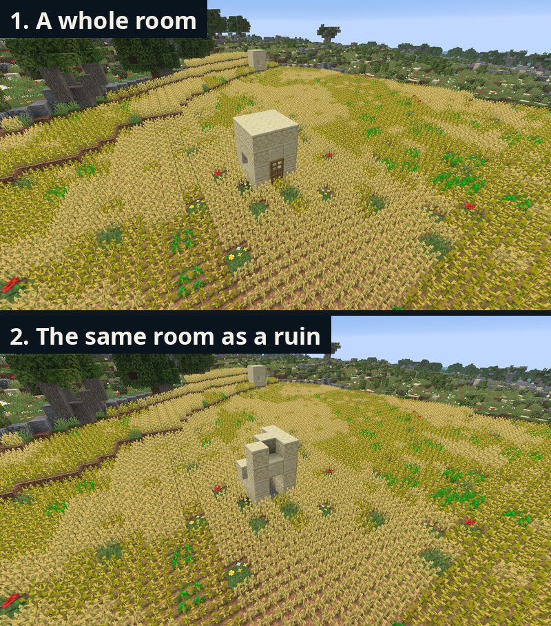
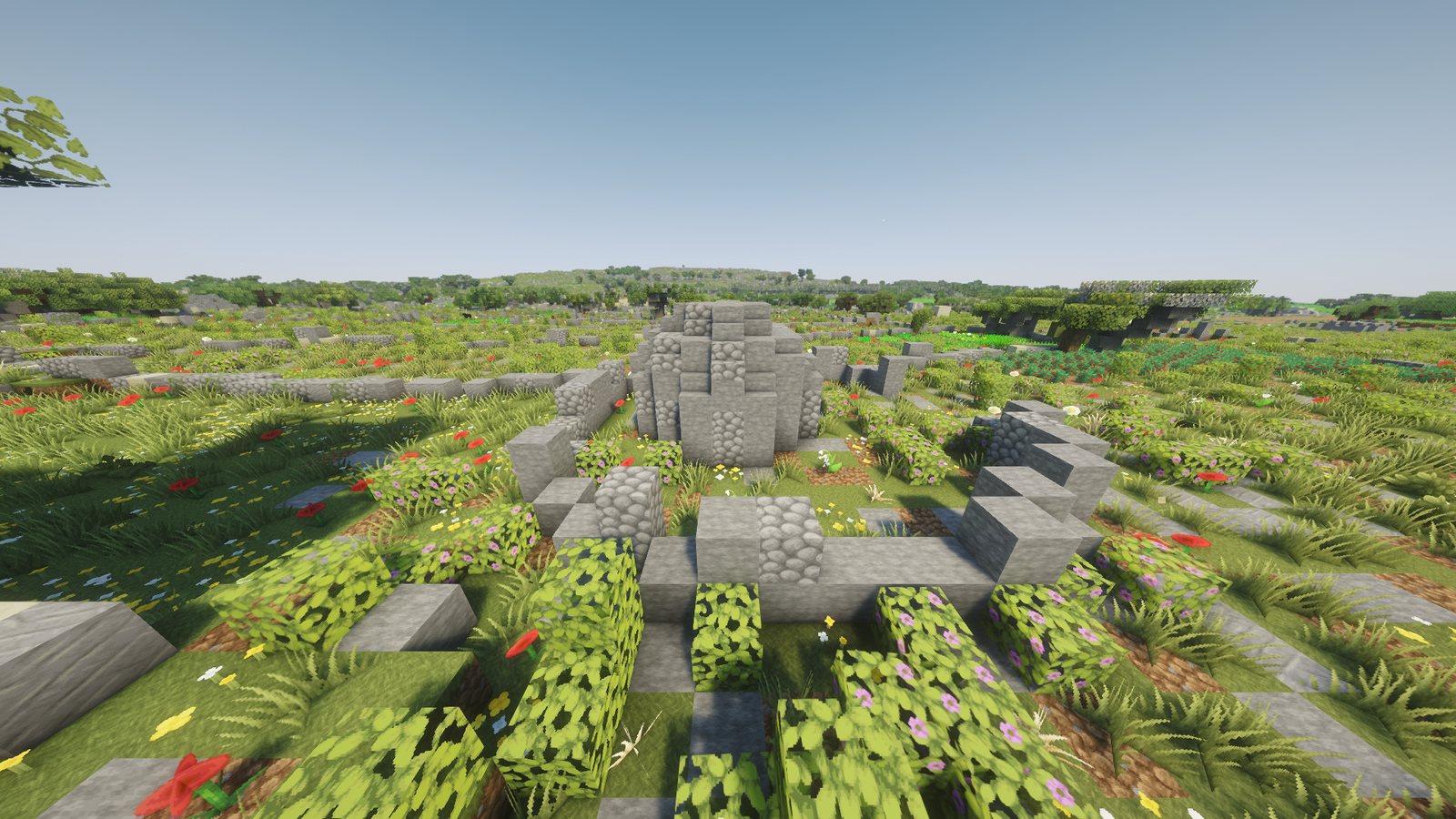
A ruined room has its roof fallen in from one end, no door, an empty window, fallen stones on the floor and vines on the walls.
What went wrong on the way
- A leaning acacia grew into a room and the room cut it, which left trunk pieces floating over the roof. Now no trunk stands within 3 blocks of a wall.
- A room that crossed a chunk border was built from only one of its chunks. The neighbour chunk then laid its own ground inside it, and I found a grass block in the middle of a room. Every chunk now builds its own part.
- The ruin rule went through three versions before the numbers looked like what I had seen on the ground.
What it taught
- Check labels with a second pair of eyes. An error that looked like 2 % was about 12 %.
- A real map beats a random rule. The drawn map put every room in a plausible place, and I never had to argue with a corner.
- When a method fails at 15 %, drop it. Placing giren by research and one good survey beat a detector with a hundred false positives.
Wiki pages and an invitation
The wiki pages show every variant and where the buildings can appear: Field room and Girna. Do you know a field where a girna stands, or have photos of one? Get in touch at [email protected].
Technical details
Field rooms. Source: the drawn map's building outlines (97,676), kept at 4 to 60 m² and up to 5 by 5 blocks. Rules: touching a field parcel within 4 m, no other building within 5 m, no building over 60 m² within 25 m, on land outside towns, salt pans and pools, ground within 3 blocks of level, roof 1 to 5 m above the ground on the 2018 surface model, a shadow on the 2018 photo, and no church, chapel or convent label within 30 m. Counts: 8,167 (Malta 6,238, Gozo 1,929, Comino none). Density 62 per km² of farmland on Malta and 55 on Gozo. The door faces the nearest track within 30 m.
Giren. Land: Upper Coralline Limestone with a field and bare karst both within 50 m. Spot: flat 5 by 5, slope under 15° over 9 m, 20 m from cliff tops, not in towns, fields, woods or groves, 4 to 7 blocks from a rubble wall when one is near, 50 m from any other field building. Density per 100 ha: 12, 4, 2 and 0.5 by region. One random draw per hectare, so the pattern is the same each time. Random giren stay 150 m from a real site. 44 sites are real (36 from Vella's map, 8 confirmed on the 1968 sheets).
Sizes. Full round: 7 across, 5 high, room 5 across inside. Small: 5 across, 4 high, room 3 across. Oval: squashed to about 72 % front to back. Square: 5 by 5, 4 high, flat slab roof. Square outside, round inside: 7 by 7 (full) or 5 by 5 (small) for two courses, then the dome. Ruin: 2 or 3 courses, top course broken, 30 % of floor cells hold fallen stone. Enclosure: radius 6.5 to 8.5, 1 or 2 blocks high, a gap at the front.
Ruined field rooms: chance = 1 − 0.98 × 0.9^w, where w is the sum, over abandoned fields within 50 m, of 1 − 0.75 d / 50 and d is the distance from the room to the nearest cell of that field. Six known broken rooms are always ruins.
Pictures: all in-game shots use the Complementary Unbound shaders and Faithful 64x. Stage pictures 1 to 3 of the domes and of the ruin are older shots without shaders.
References
Vella, E. (2012–2013). A stratigraphic study of the giren at Ix-Xagħra l-Ħamra, limits of Mellieħa, Malta. Malta Archaeological Review, 11, 68–78.